
This is the first blog post this year! My! how time flies? I haven’t been out walking for a while, well, since before Christmas to be honest. My forays into the great outdoors were curtailed in the New Year by a very heavy cold, and once this had started fading I had the sybaritic pleasure of a trapped sciatic nerve which figuratively and literally was a pain in the arse. The occasional weekend has been lost to home decorating too – a toss up between the sciatic nerve and decorating as to which was the most pleasurable. I’ll let you decide.
The walk featuring on this post was up Helvellyn. I had been knocking the idea around my friends and neighbours in the village pub where I live, and a number of them quite fancied doing it, but trying to get a consensus on who could do what, and when, was proving a difficult task. I do find that one has to be spontaneous with the outdoors, and you cannot plan on the weather being right so you have to seize the day when the weather provides the opportunity. Unfortunately my friends and neighbours social lives do not work around spontaneity due to football games, grandchildren minding duties, assorted family commitments and wanting to be back home on a Sunday at 4:30pm to start cooking tea when you live alone. As a result of this potential hassle, the walk was just me and Mrs Muddy Boots. It was by no means a new experience for me as I have been up Helvellyn more times than I actually remember and from a variety of different routes at all compass points.
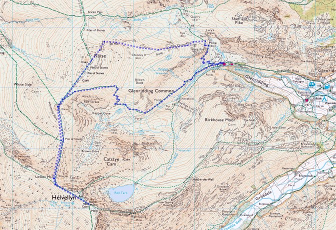
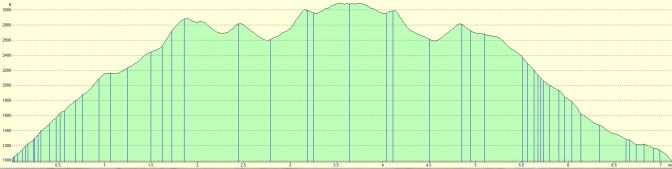
Distance – 7.12 miles
Ascent – 2801 ft
Estimated Time – 6 hrs
We decided to drive up to Glenridding and go via Shap and the Penrith M6 exit, certainly not shortest of routes to Glenridding, but it does avoid Kirkstone Pass and so could be quicker. On the exit from Penrith we called at the Rheged Centre to buy a pair of tickets to the forthcoming Premiere Weekend of Blencathra: Life of a Mountain, the second Lake District documentary by award winning producer and director Terry Abraham, and sequel to the excellent Scafell: Life of a Mountain. Terry is not your ‘usual’ media type, he has a passion for the hills and also for what he does, and more to the point, he is an all round good bloke too. Watch his stuff, it is well worth it – see here for more details of Terry’s web pages, and Terry’s YouTube Channel
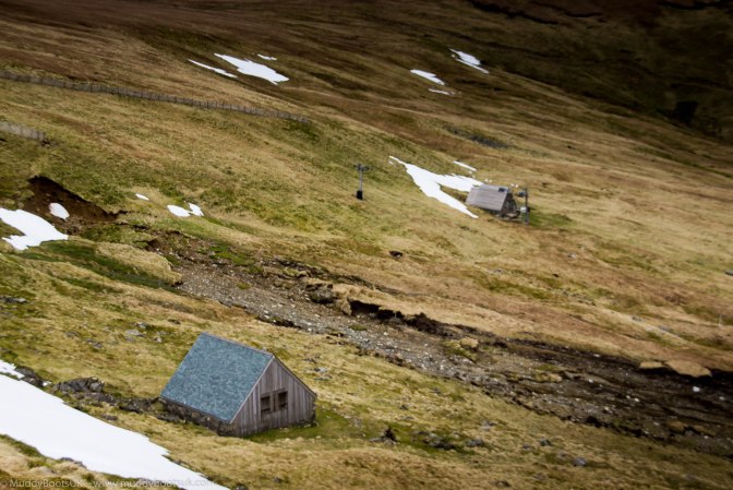
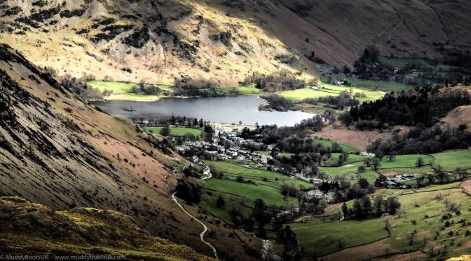
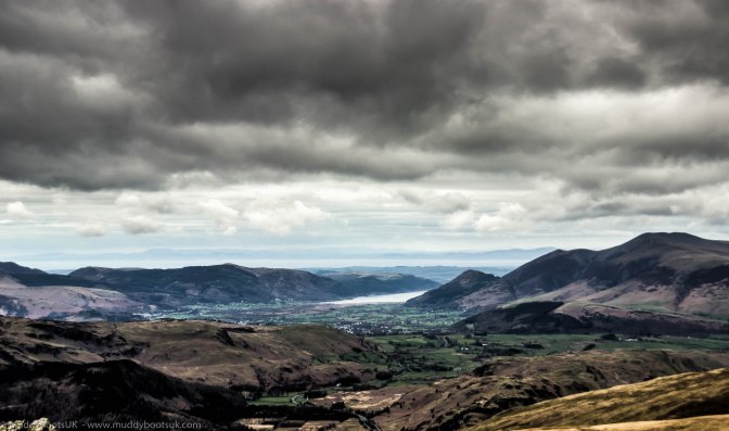
Having procured the tickets, and safely stored them away we continued our journey down past Stainton, which holds a number of special memories for me, and then alongside Ullswater to Glenridding. The evidence of the recent floods was still writ large here, with construction machinery and scaffolding still in evidence. We parked at the large car park in Glenridding, and when we went to pay the parking fee we found the card readers for paying the car park fees were out of action, and this posed a dilemma, as being like the Queen and not carrying any cash we had to go and park elsewhere. We drove up towards The Travellers Rest and left the car near there. A quick change to more suitable footwear, and hoisting the rucksack onto my back, we were off. We progressed up the valley to Greenside Mine, a now disused, but still utilised lead mine. The old mine buildings now form a motley collection of outdoor type hostels, including an official YHA place. It is good location to stay, being surrounded by some superb fells.
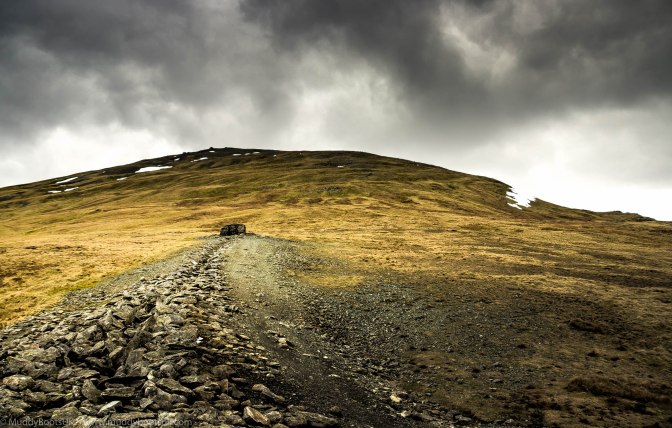
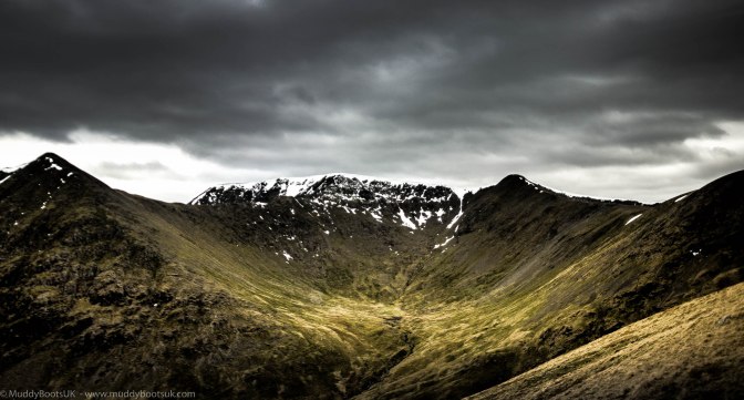
We took the zig-zag path up by Swart Beck and as we climbed we looked forward to the delights of Lucy’s Tongue. The sudden and steep climb up had us soon gulping for air and stopping frequently to take in the view, and to get our breath back. The path here is a continuation of the Bridleway that forms Sticks Pass and had the appearance of a cart track – I certainly wouldn’t like to be the horse pulling a cart up this slope. We continued plodding upwards and followed the line of Swart Beck and as we approached the summit of the beck we came across a number of cave rescue personnel undertaking a training operation in what was possibly an entrance to the old mines themselves. The ground began to level out and the going got easier as we got closer to the old mine tips. The landscape was quite bizarre up here, and really resembled a moonscape which was the end result of years of mining. At one point we came across a large expanse of sand which formed a ‘beach’ adjacent to Sticks Gill which did look out of place – all that was missing was a bucket and spade and an ice cream seller. In the far distance to the East, below the line of Sticks Pass, we could see the small, triangular shaped, wooden huts of the Lake District Ski Club.
We decided to take the route along the line of the old chimney flue instead of walking along the flanks of Greenside and the Sticks Pass bridleway. The chimney flue route is regularly used as a path to the Ski club huts by its members. What on Earth is a chimney flue doing up here you may ask? The chimney flue was part of the processing works at Greenside Mine. The lead ore processing gave off quite toxic fumes, and so this chimney and flue were constructed to avoid poisoning half of Glenridding when the wind was blowing in the wrong direction. It is some substantial achievement too, however the chimney at the flue termination is nothing Fred Dibnah would be proud of. We continued up the line of the flue along the flanks of Raise, and steadily made progress towards the Ski huts. We decided to take a break near to the chimney and have a sandwich, and to my surprise Mrs MuddyBoots had secreted a sneaky can of beer in her rucksack which certainly made a nice addition to our lunch stop.

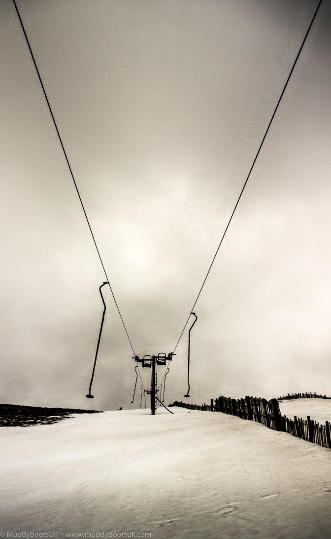
After attacking the sandwiches we continued our way upwards and leaving the chimney behind, the path became very indistinct; it is very different in winter as you can see the route others have taken, but once the snow has gone the path disappears too. We slowly worked our way to the toblerone shaped Ski Hut, passed through the timber fences either side of the piste and got ourselves onto the eroded walkers highway that is Sticks Pass.
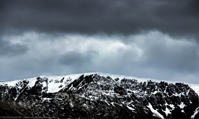
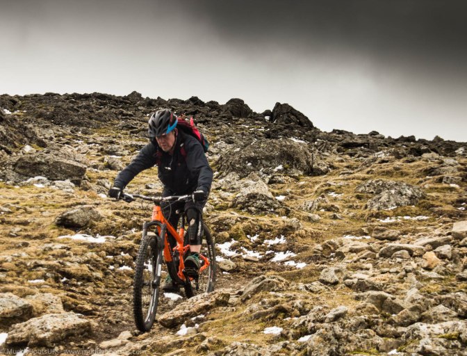
The going underfoot was certainly easier, but the wind was incredible! We had been in the lee side of the hill on our way up and had felt very little breeze at all, but now we were on a high ridge that runs straight to Helvellyn summit with the wind funnelling straight up the hills to our right overlooking Thirlmere and gaining further speed in the process. It was the sort of wind that catches a hold of your legs as you walk and tries to make you misplace your feet. We continued onwards along the wide path and lost altitude going down to a col above Red Screes only then to climb back up to the summit of Whiteside Bank. To our surprise a couple of mountain bikers appeared over the summit and were making their way down, which was impressive due to the fact that they must have pushed their bikes up to the summit of Helvellyn first in order to make this descent. The MTB’ers passed by us and the ride down looked great fun. The view from the summit was excellent though, with great long range visibility right up to the Solway Firth, and beyond.
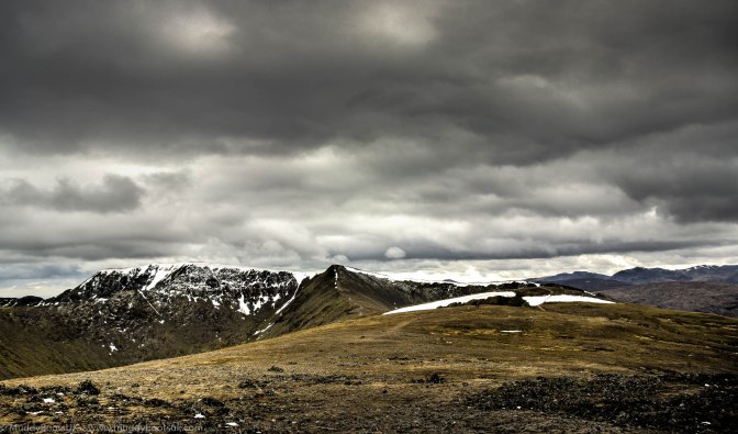
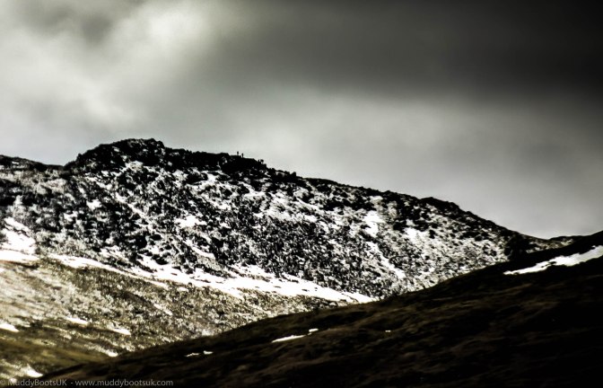
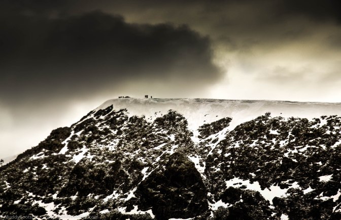
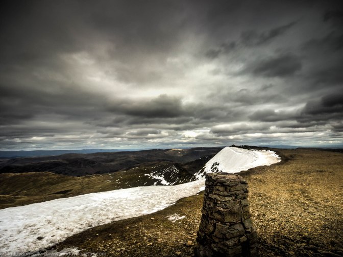
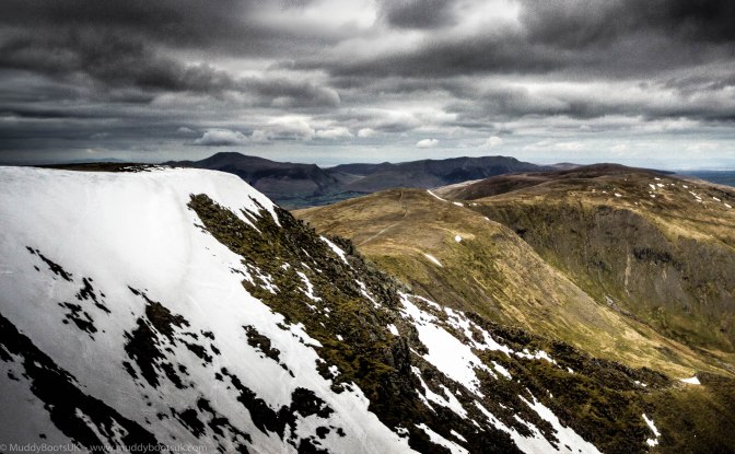
Yet again, we went on the roller coaster walk downhill to a ‘Pile of Stones’ according to the map, to then get to the steep rocky approach of Lower Man, which was just one huge pile of stones. From this low, foreshortened angle it really did look quite steep, and my memory of it being like this had faded with time. We gradually ascended Lower Man, and between the puffing and panting we got onto the path leading to the summit of Helvellyn. The approach to Helvellyn summit gradually got easier and the path snaked south west well away from the North East facing cliffs. There was still a substantial cornice overhanging the cliffs and the steep drop down to Red Tarn beyond them and fortunately no footprints in the cornice either – the foolhardy mustn’t have been up here for a while. We passed by the summit cairn and made our way to the summit shelter, a cross shaped stone wall with built in stone seating. This was the first time ever that I had got to the summit of this place and had it to myself (well, apart from Mrs MB). We sat and finished the sandwiches, and she magically produced another tin of beer! The highest beer I had ever had in England. We sat at the summit for about twenty minutes whilst we finished our lunch and consumed the beer, and gratefully took shelter from the incessant wind. I did note a number of cigarette ‘dog ends’ scattered around. I know smoking is classed as anti-social, but I didn’t think smokers were so inconsiderate as to leave remnants of their habit up here too. I had a mental image of someone struggling to get to the summit with all the fresh air that was blowing around, lifting their yellow, bony, nicotine stained fingers up, sparking one up, taking a huge lungful before declaring loudly “..That’s better!“… with a couple of lung wrenching, rasping coughs afterwards just to emphasise the point.
We packed our rucksacks back up and made our way down. For the first part of the route, the way down was the same as the way up. As we picked our way down the ‘quarry’ that was Lower Man and reached the lowest part at the Pile of Stones, the sight of another upwards plod to Whiteside Bank didn’t really fill us with any joy whatsoever. We trudged onwards, the wind still doing its best to knock us over and step by step we arrived at the summit of Whiteside Bank on the return leg. It really didn’t look this far on the map.
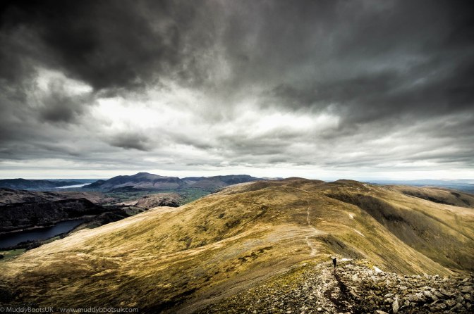
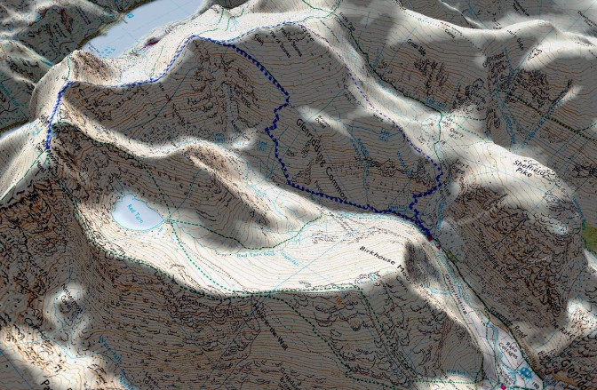
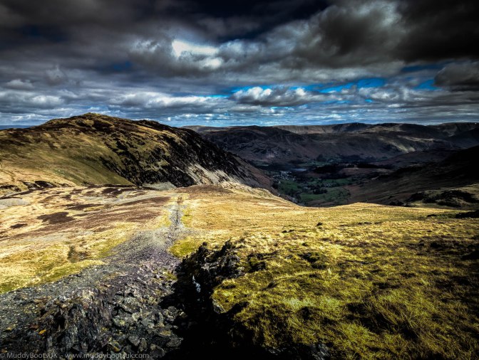
At this point our route diverted from the one we came up and lead us south of Raise summit to a path that crossed above Red Screes which gave a great view down to Brown Cove and Keppel Cove. The path here was superb and looked to be recently refurbished, possibly by the ‘Fix the Fells’ team, I don’t know who did it but it made for pleasant going. This was the lull before the storm, as the path progressed it got very steep and took in a number of S-bends that would make an Alpine pass a walk in the park. It is great to find a well made path such as this, but my knees really took a hammering on this way down. I usually find a walking pole helps take some of the punishment off my knees, but I didn’t bring it with me. It does become hard work juggling a walking pole and a DSLR at the same time and a third hand would sometimes be useful.
We continued zig-zagging down the gravel track at the side of Glenridding Common until we got onto the route leading from the disused dam below Keppel Cove. Here the gradient thankfully levelled out and we then had a steady and rapid descent all the way back down to The Travellers Rest.
We usually call in for a pint at the nearest pub at end of any walk, but today we felt so weary that we just changed our boots, climbed in the car, sat there for a while and decided to drive straight back home, where we had a curry awaiting us. The Travellers Rest would have to wait until another time.
It is a good route to take to get up to Helvellyn summit and does avoid the ridge of Striding Edge and Swirral Edge. I have done Striding Edge a number of times, even in winter with crampons and axe, but Mrs Muddy Boots didn’t really fancy doing it again (once was enough apparently), hence this alternative route.
