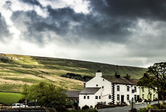
Today’s walk is a bit of something different and I pondered long and hard over the map to try and find somewhere that I was unfamiliar with within the usual areas of the Lake District and the Yorkshire Dales. As usual one of the main governing points relating to walking was the inclusion of a suitable pub, and the pub featuring today is the Moorcock Inn which is just down the road from Garsdale Station. I had been the past the pub numerous times previously whilst driving along the A684 towards Hawes. I did a little bit of research on the Internet prior to setting off on the walk and it transpired that the pub was under new management and have been closed for a brief time for refurbishment so this seemed quite promising, and another appealing point about it was the curiosity I had harboured when I had passed previously.
As usual we set off on a Saturday morning and approached via Sedbergh on the A684 Hawes road. We managed to park at the side of the road near the adjacent junction with the B6259.
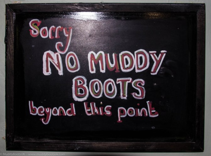
We got out of the car, changed our footwear and pulled our rucksacks out of the boot and made a start on the route, however, that start proved to be short-lived because Mrs Muddy Boots needed to use the loo and so a visit into the Moorcock Inn was required so she could use the facilities. We walked around to the front of the pub and entered through the door and were pleasantly surprised by the internal layout, with the large room on the left being a relaxed seating area with a counter at one and providing coffee, teas and cakes, and the area to our right containing the public bar and dining area. The ‘coffee’ area had stone/slate flooring whilst the dining area to our right was carpeted, there was a large sign reminding inconsiderate walkers about their footwear when entering the dining area.
Whilst Mrs Muddy Boots availed herself of the facilities I went and purchased two large coffees, a scone with cream and jam, and a substantial piece of chocolate cake and took a seat by the window. I can’t remember the exact cost for this but I did check with the lady behind the counter to see that she added it all up correctly as it seemed a little low, however she confirmed that the price was correct – Yorkshire prices again! You can’t beat’em!
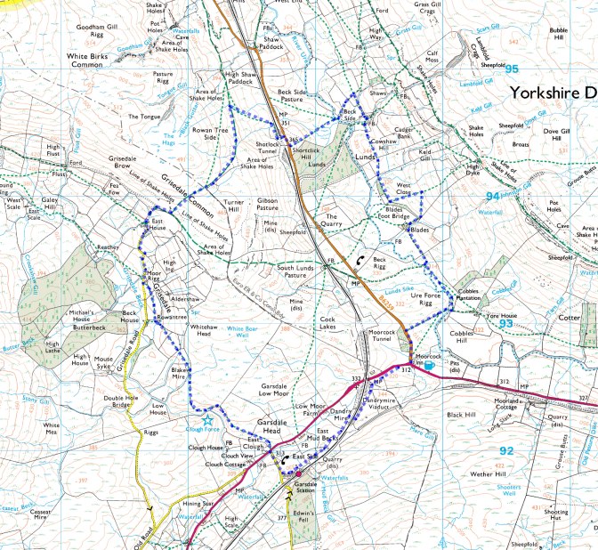
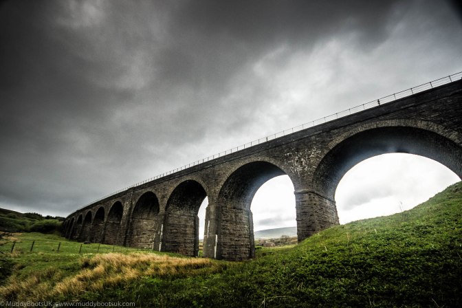
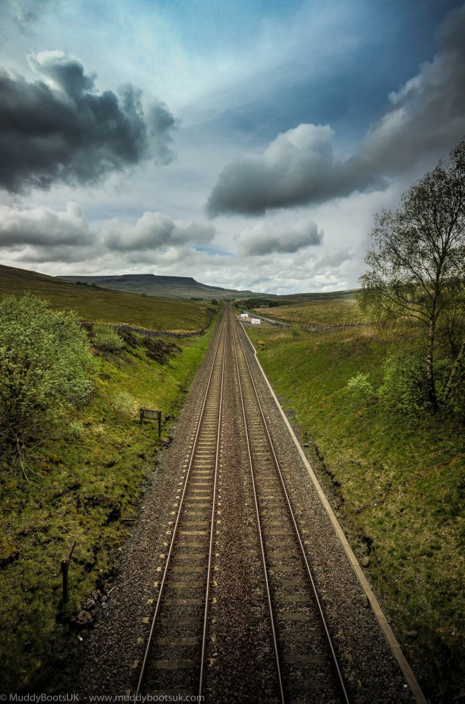
We lingered over our coffee and cakes and then decided we really had to make a move and exited the pub via the front door and turned right onto the main tarmac road. After a short time of walking west along the road we came to a signpost on our left which indicated the Trans-Pennine Bridleway, we took this route and headed towards Dandrymire Viaduct on the Settle and Carlisle line, we passed under the vast structure and then started a gradual ascent of the path leading to Garsdale Station.
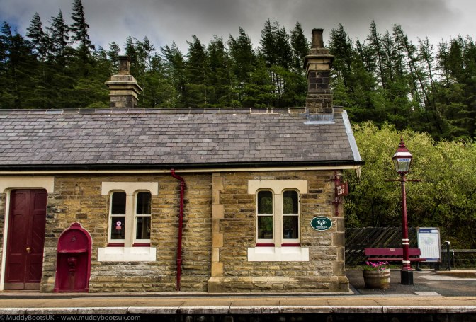
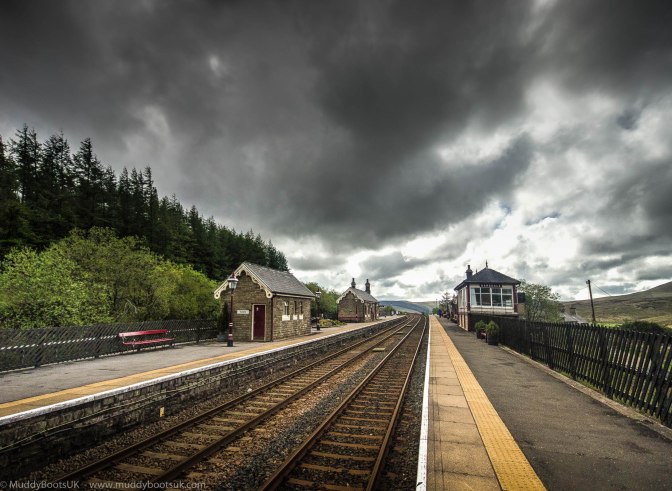
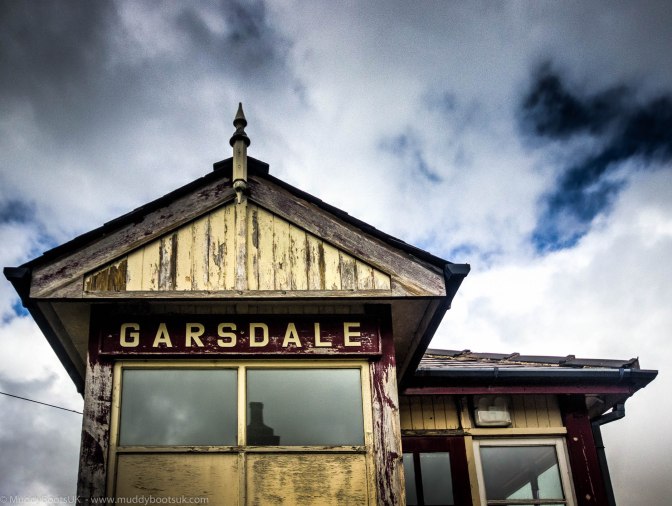
We ventured slightly off the planned route and walked onto the platform of Garsdale Station itself, and came to the conclusion that it was a shame that the majority of railway stations in this country were not of the same high standard of architecture and upkeep. It had all the appearance of being a heritage line, not an actual station on the national network. The station was built in 1876, as was Garsdale Head itself, which is a collection of railway workers cottages and the station buildings themselves. It was originally called Hawes Junction however this changed when the line to Hawes was lifted (although the Wensleydale Railway is trying to reinstate the tracks back along their original route)
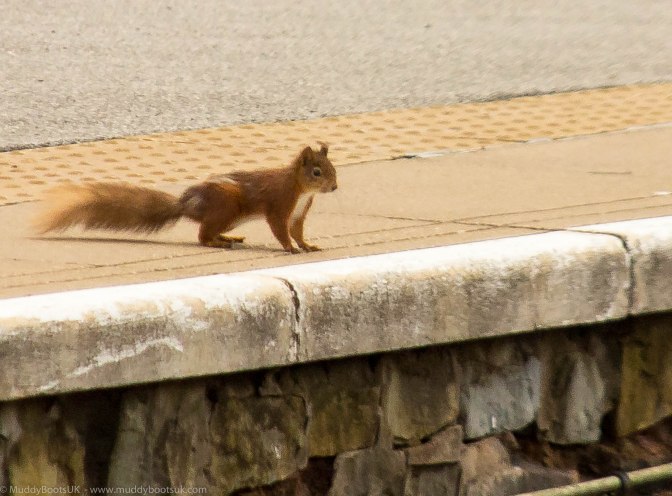
Whilst mooching about on the platform I spotted a little red squirrel which had come from the pine forests situated to the south of the down platform and it skipped, hopped and darted along the platform, then down onto the track, across the track and then scurried up onto the platform I was stood on and subsequently disappeared between some of the nearby houses – I went to try and find it to get a close up shot, but couldn’t see it anywhere. I was really pleased at seeing this as red squirrels are a rare treat and I was fortunate to have my camera to hand and grabbed some shots of it.
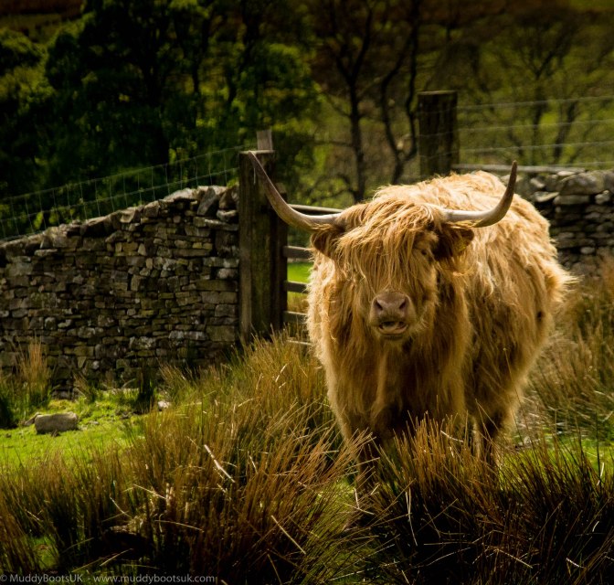
We departed the railway station and descended the tarmac access road until we got back onto the main Sedbergh to Hawes Road. We crossed at a farm called East Clough and then headed upwards through a field with Highland cattle and plenty of mud. Mrs Muddy Boots wasn’t happy about the cattle at all, as she convinced herself that they were all bulls and they were going to charge, in my view they look quite friendly and just generally disinterested.
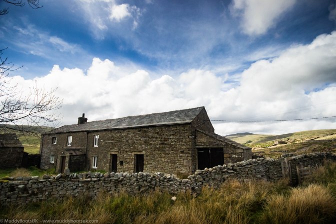
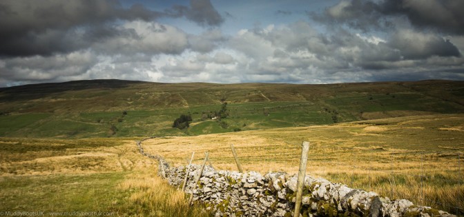
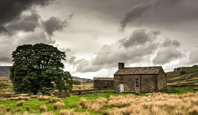
We soon reached a wild, grassy plateau and looked down into the valley to our left in which ran Grisedale Beck, and tried to see what was highlighted on the map as Clough Force, however there was very little to be seen, except an excavator down in the bottom where the beck ran which appeared to be clearing the remnants of the recent flooding; it was possible that Clough Force had been swept away or we were looking in the wrong place. We continued walking along the footpath and came across a recently renovated vernacular Pennine farmhouse which is marked as Blake Mire on the map. It had a new access road created to it and the view from this location was quite extensive and uninterrupted which gave the appearance of it being quite isolated, which it could be after heavy snow.
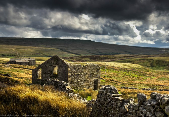
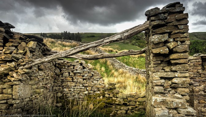
We passed through the small picket gate in the surrounding drystone wall, past the shippon end of the farmhouse and we picked up the new access road rather than the public footpath and this quickly took us down to Grisedale Road, which is the main public thoroughfare that runs up the valley and forms the main access route for these isolated farmsteads. Grisedale Road is marked as a public road on the OS map but is really single track tarmac strip and has clumps of grass growing through the centre of it due to its lack of regular traffic. We continued walking north on Grisedale Road and gradually ascending the side of the valley. Grisedale itself is now largely unpopulated but was at one time an area of quite extensive farming, and higher up the valley there are a large number of now derelict farm buildings such as West Scale and East Scale farms which have an romantic, secluded isolation to them, although it is a bugger of a trip to nip to the local shops – I presume Tesco would do deliveries here though.
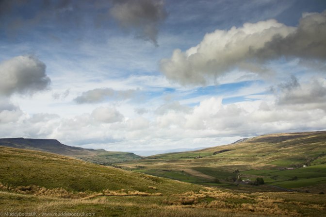
We continued walking up the metalled road until we got to East House which is the last farm on this road. The tarmac road continues past East House, going steeply uphill until the tarmac abruptly stops and the route turns into a gravelled bridlepath that runs along the side of the valley at high level. This appeared a little odd at first, as though the tarmac gang decided to knock off on a Friday afternoon and then come back on Monday to continue laying the black stuff and just didn’t turn up again to continue the job. Once we got to the end of the tarmac road the path actually levelled out and we had a choice of turning left, up and over Grisedale Common, or continuing along to South Lunds Pasture. Being the gluttons for punishment that we are, we turned left up the hill and across the tussock strewn moorland grass, and headed along the bridlepath over Turner Hill and then down towards High Shaw Paddock. The steep uphill climb soon had us out of breath and panting, and we had to stop a number of times to get our breath back and to take in the extensive views. As we were ascending Grisedale Common we were being followed by two other people with large rucksacks who gave the impression of backpacking somewhere, although the major long distance routes were not nearby. We continued along the bridlepath, reached the summit of Turner Hill and began the easy descent down to High Shaw Paddock.
On the approach to High Shaw Paddock took an offshoot footpath to our right that led to Shotlock Tunnel. The field in which we walked through was a little rough underfoot with very little definition of the path and made for quite hard going, it was obvious that the footpath through it had not been used in years. We quickly descended the hill and arrived at a small metal gate along which which was a gravel track parallel to the railway lines, we passed through this and turned right over Shotlock tunnel and back onto the B6259 road leading up to Mallerstang.
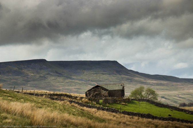
After crossing the tunnel we arrived at the road and took a right turn to the south west and after about 100 yards we climbed up a steep road embankment to a public footpath that lead through a wall and down a hillside to an area called Beck Side. As in Grisedale, there were a number of run down and derelict farm buildings here, and it must have supported a much larger population that it does currently.
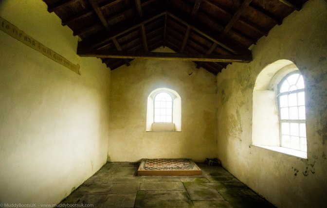
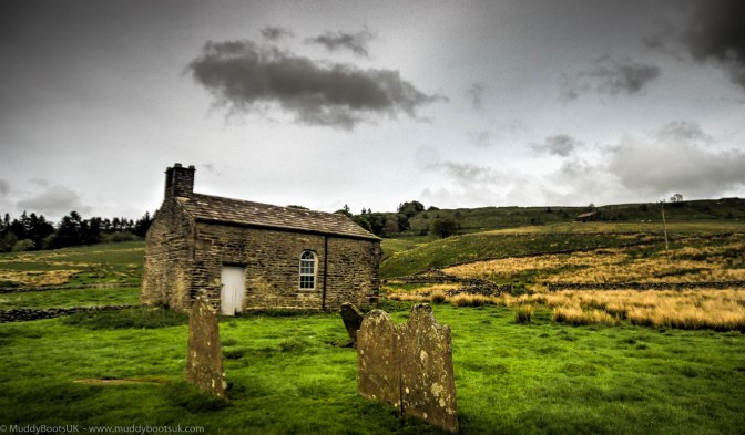
We crossed over the infant River Ure and walked alongside it for a short distance, this obvious riverside path removed some of the planned route and we bypassed some recently rebuilt farmhouses in an area called Lunds. The footpath we took actually ran past what appeared to be an old chapel with a number of long neglected grave stones within the consecrated ground surrounding it. We paused here for a short time and actually went into the chapel itself which was a small stone structure the small valve tower at one end and was whitewashed internally with a timber pew against one gable. There was very little information about this building so I made a mental note to look it up when I got back home to find more about it. It was quite sad looking at the structure and the surrounding gravestones as they have long been forgotten by the families that had paid for them to be erected and to act as a memorial to their loved ones. The majority of the headstones were over 200 years old and date from when the population of this area would have been much larger than it is now. The descendants of these people are most likely moved on to other parts of the country or even the world and wouldn’t know they even exist.
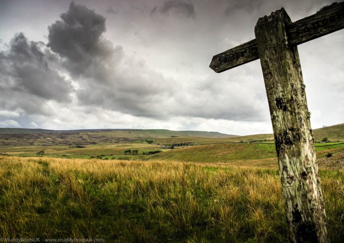
We left the little chapel at Lunds behind and ascended Cowshaw Hill with its lone timber signpost indicating the route of the public footpath we continued making our way along to Blades Farm. On the way to Blades Farm we happened to cross one of the worst fields in existence.
The footpath was marked across the field on the map, however we could see no sign of it when we got there.
.0a1
nd had to make out an approximate route from A to B. The ground underfoot, which could not be seen due to the length of the grass, was rutted and uneven and increased the risk of twisting one’s ankle. After struggling across this extremely poor ground for fifteen minutes we arrived at the farm track that led to the Blades habitations, and we both agreed that this was the worst path we had ever crossed in a long long time and just walking steadily on even ground was a blessing. We continued along the farm track that led to Blades and passed left through a small gate, behind the buildings and crossed a small secluded beck, and ended up on a gravelled track that provided access to Blades.
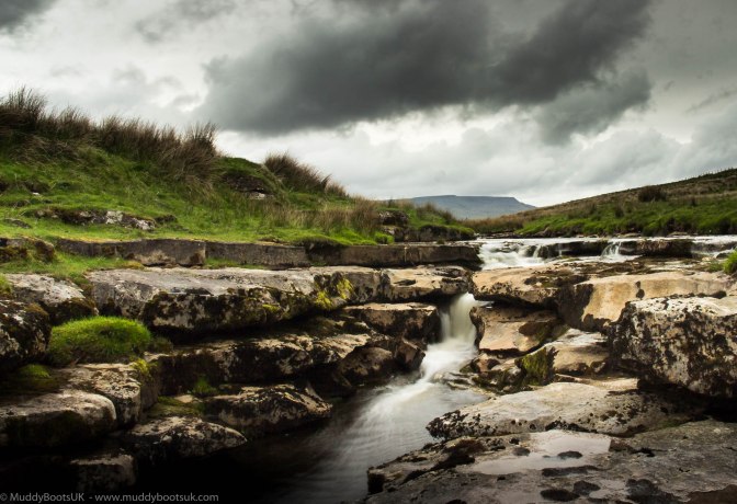
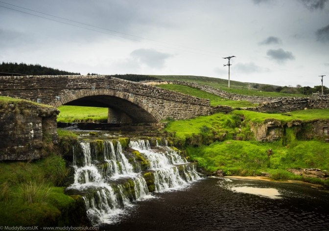
Soon this left the Blades access road and turned into a public footpath running alongside the River Ure we stopped at Ure Force where the river tumbled down a number of limestone slabs and created an interesting waterfall and pools.
At this point we walked onto a well made track and a substantial bridge crossing the River Ure which led from Yore House back to the main tarmac road leading up to Mallerstang. We took an obvious shortcut of a footpath along the nice grassy swathe which brought us out directly to the rear of the pub.
We arrived back at the car and changed our footwear (again!) and decided to go back into the Moorcock to rebalance our fluids and also to peruse the menu. We entered the pub and as I approached the bar and ordered a couple of drinks, Mrs Muddy Boots found a table and read through the menu. The menu wasn’t huge, but appeared to be good home cooked food; nothing fancy, nothing drizzled, just good cooking which one would expect in a pub like this. It turned out on reading the menu that this was a “temporary menu” and was only in place until the new owners had managed to find their feet and produce something better – I really hope they stick to well produced ‘pub food’ and not gastropub stuff with jus’, drizzled this and that and pan-seared stuff. The pub was busy but we found a table, sat down and sipped our drinks and studied the menu. A large number of people in the pub were eating too, so we could see what was on offer as various plates of food were brought out, and it looked good too, so we proceeded to go back to the bar and order our evening. We both went for steak pie and chips; the pie was home-made and the proportions provided were more than ample for two hungry walkers. We got stuck into the food when it arrived and really made short work of it, and due to the proportions we had to decline the pudding. After finishing our evening meal and ordering some more drinks the time to leave arrived and we had to reluctantly face the long drive back home.
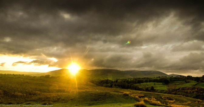
As we made our way along the A683 towards Sedbergh, and the M6, and drove west into the setting sun, we were treated to a superb sunset with the sun dipping behind the Howgills which was a fitting end to a great day’s walking.